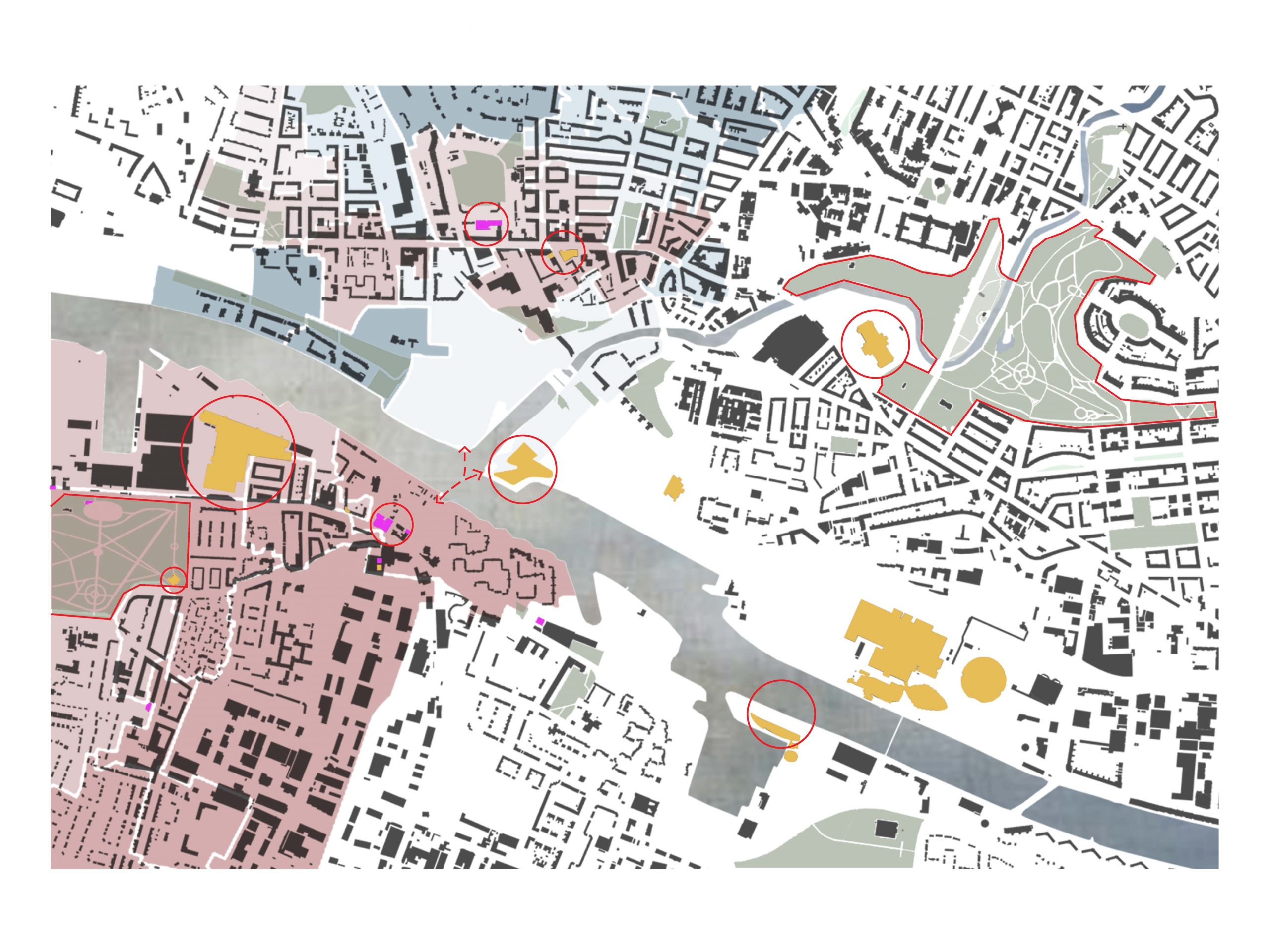
As well as providing opportunities, cities do also have a high concentration of unemployment, poverty and segregation. In order for the socio-economic state of a district to flourish, one of the essential factors is social – and urban connectivity. An inclusive city needs to offer connectivity to all its inhabitants. The presented illustration focus on Govan and Partick, two city districts with historical and industrial importance to Glasgow. The map explores the socio-economic state of the districts and the possibility for participation in available activities.
Dark red signifies the most deprived, and dark blue signifies the least deprived urban zones within the two districts. The yellow buildings represent cultural activities, and hot pink represent community-based activities. The red circles and boundaries indicate admission free activities and community-based participation.
The dashed line reaching across the River Clyde represents a new link proposed to connect the two districts. The connectivity the link adds to the urban fabric will provide opportunities to strengthen the socio-economic state of districts. The figure shows a clear distinction in deprivation from the north to the south side. The result of the mapping might suggest the importance of bridging a gap between deprivation zones to ensure a more sustainable outcome of the new link proposed between Govan and Partick.
Key Themes: Boundaries, Inequality