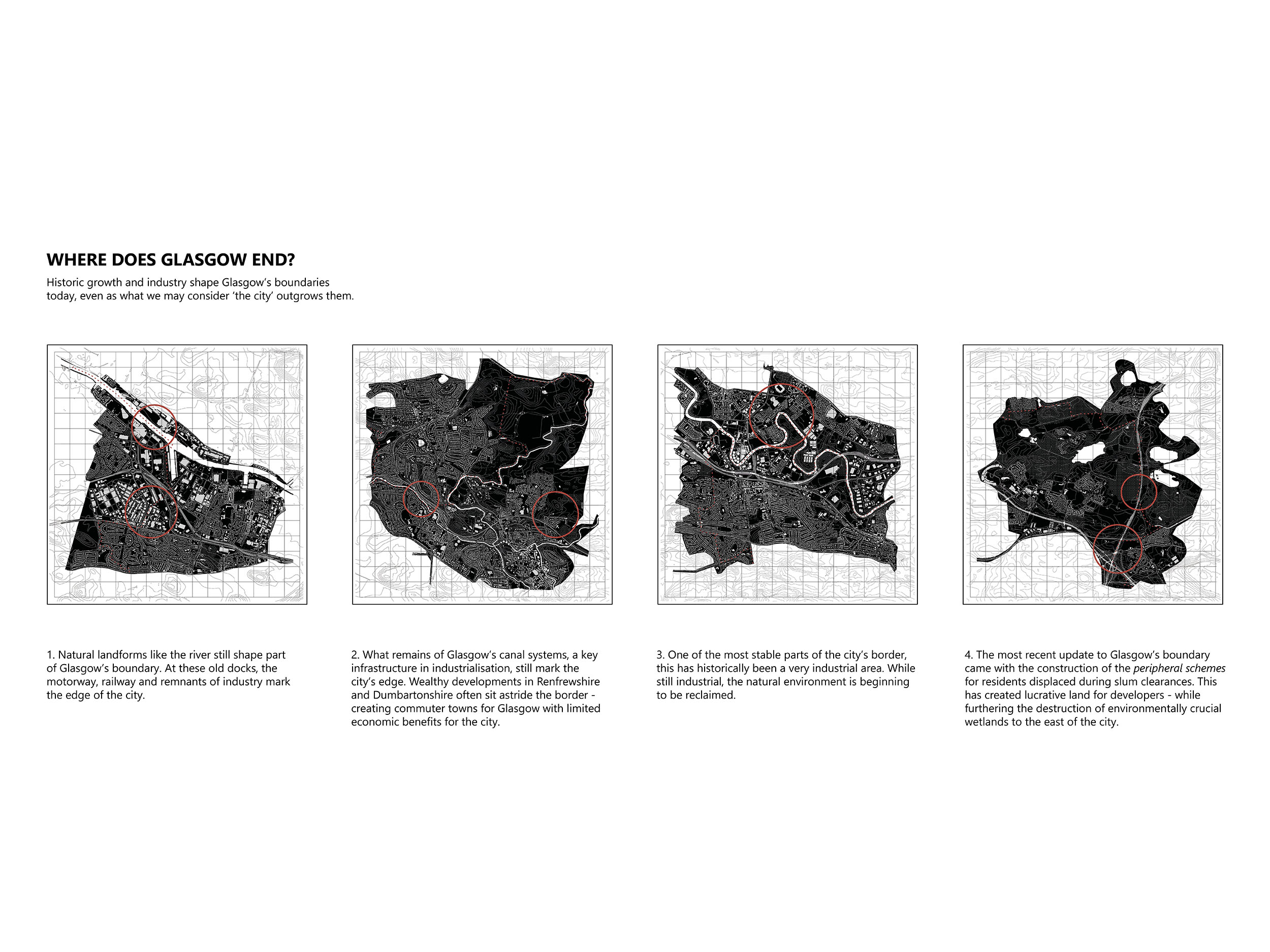
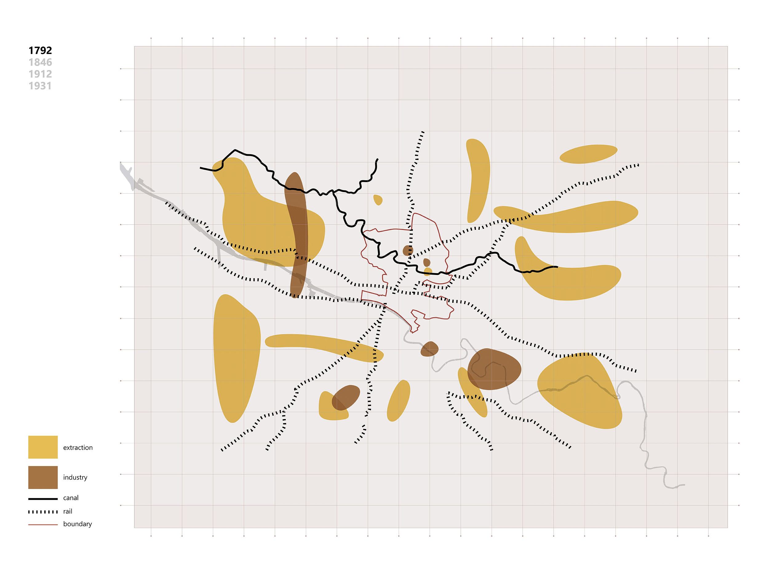
Since the Industrial Revolution, Glasgow’s size has boomed. Until the mid-19th century, the city was confined to its medieval boundary – protecting the common land which surrounded it. However, with the growth of industry came the need to expand – but where? Glasgow’s boundary reflects the city’s reliance on extraction from the natural environment and the industrial processes this fuelled. The canals and railways were constructed to transport coal, stone, iron and clay from outside the city’s borders to the factories and shipyards within or on the edge of it, while the inner city grew from the wealth this generated.
This growth pattern of ‘un-building’ the natural environment outside the city to facilitate the ‘up-building’ of the urban core is one which Neil Brenner describes in his essay ‘The Hinterland Urbanised’, questioning our focus on the city centre as the only manifestation of urbanisation and capitalist growth. Rather than viewing the urban centre and the industrial edges in isolation from each other, I am interested in how their relationship has shaped the city and its connection to its surroundings. With the trend towards globalisation and deindustrialisation in the UK, these relationships have become less geographically immediate but no less relevant; this pattern of depletion and exploitation is continuing to fuel the growth of the city, even if the global scale means it isn’t directly visible to us.
Key Themes: Infrastructure, Growth, Boundaries/Borders, Industry