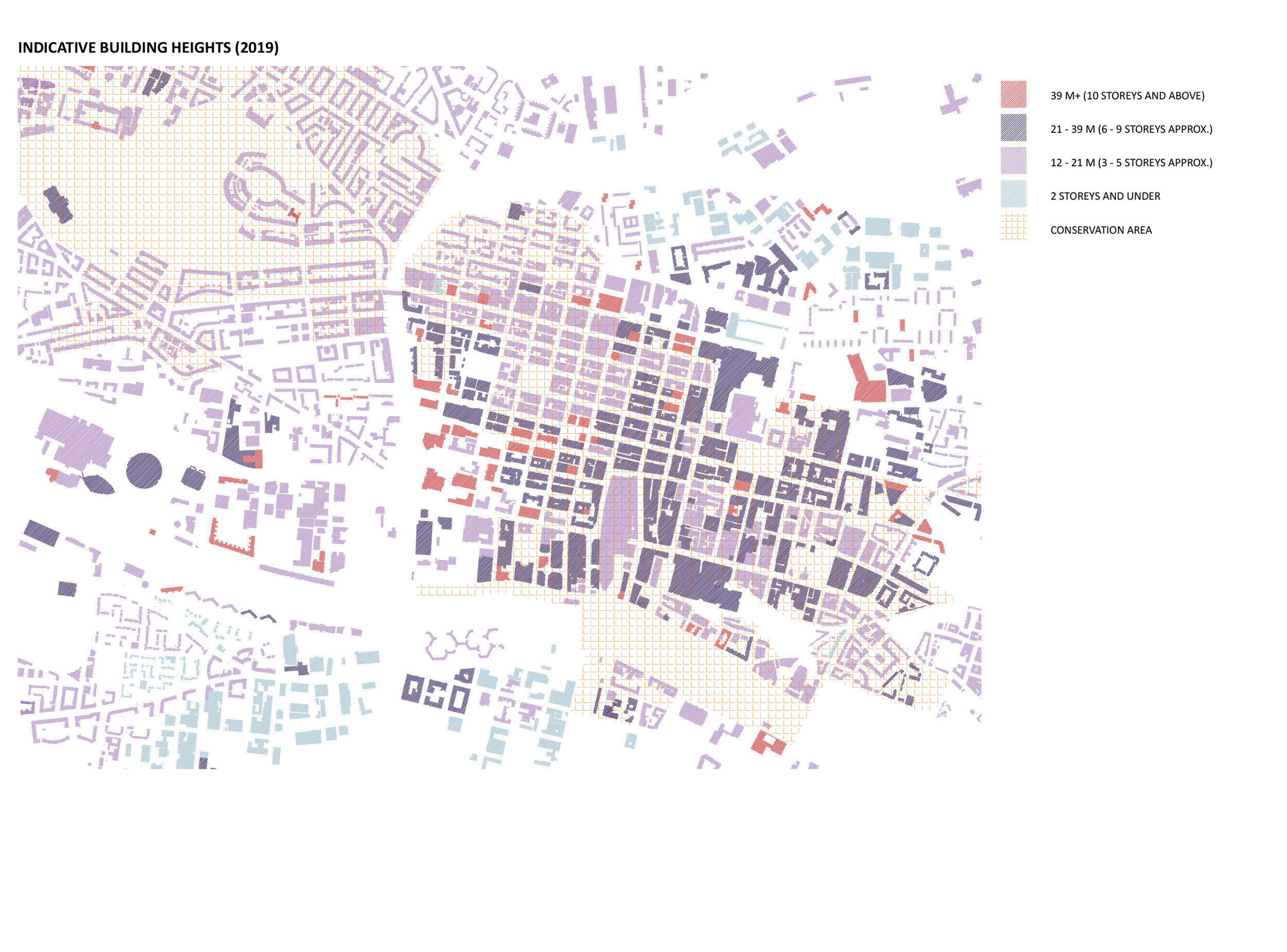
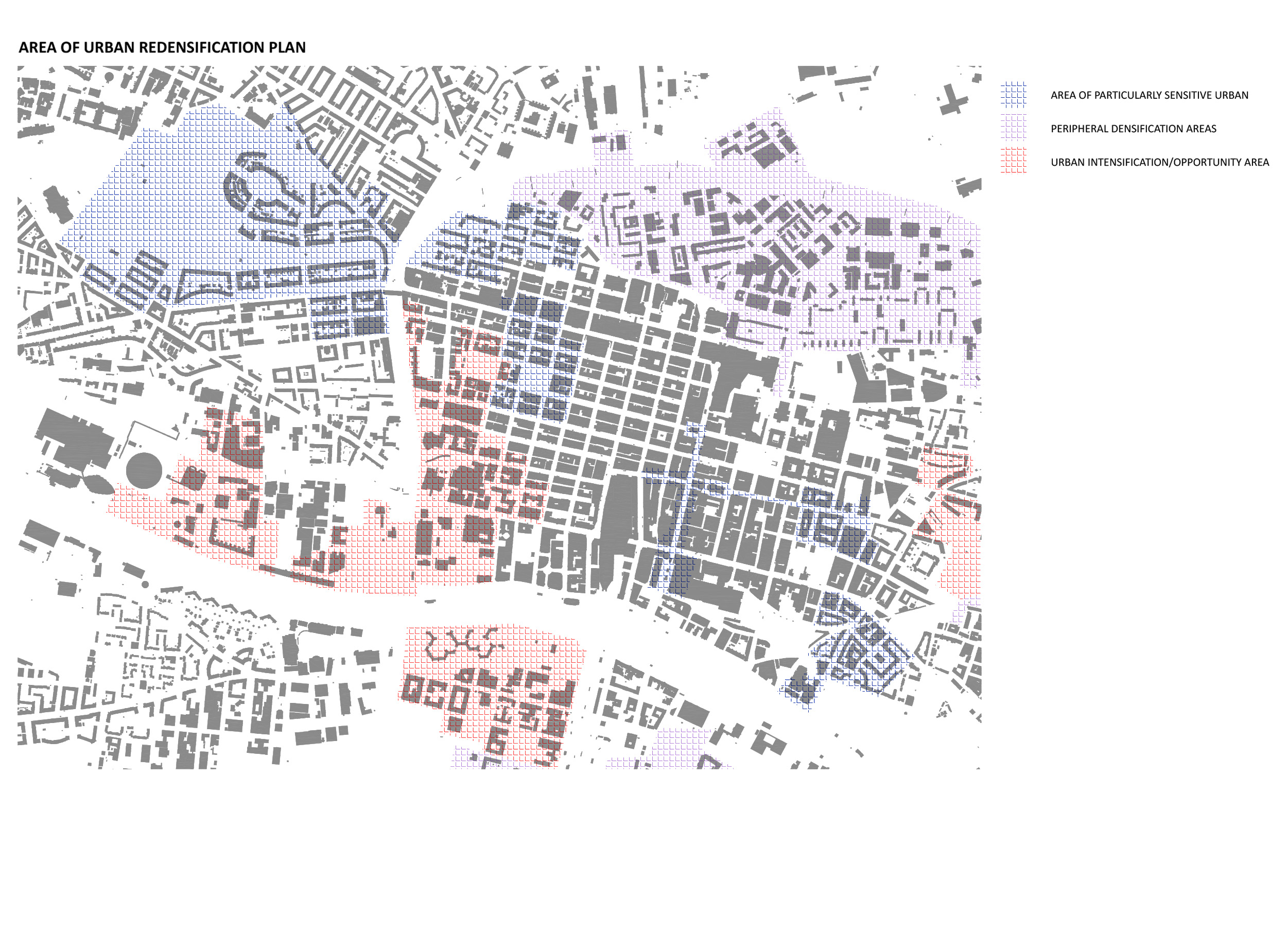
By 2050 the population in Glasgow City Centre is expected to double, resulting in a more diverse and denser city centre. These maps are showing the current indicative building heights in relation to the city’s area development plan. Within the central Conservation Area, with sensitive urban characters, the existing building height datums should be respected, and new design should creatively integrate old with new. In the North-East (Peripheral Densification Area) of the city, a tenemental and more human scale development is expected, in order to restore connectivity and relevance to the inner-city centre. In the South-West (Urban Intensification/Opportunity Area), the former industrial area with vacant and underused land, is more suited for larger, taller blocks and wider streets. It is an opportunity to redefine both the riverside area and the problematic M8.
The re-densification plan hopes to make the city centre more live-able and to attract more people to move to the city and create a lively social community. Along with the new development and the population growth, the building height datum will evolve, indicating the new morphology of the built environment and redefining the city.
Key Themes: Morphology, Land Use, Area Management, Community