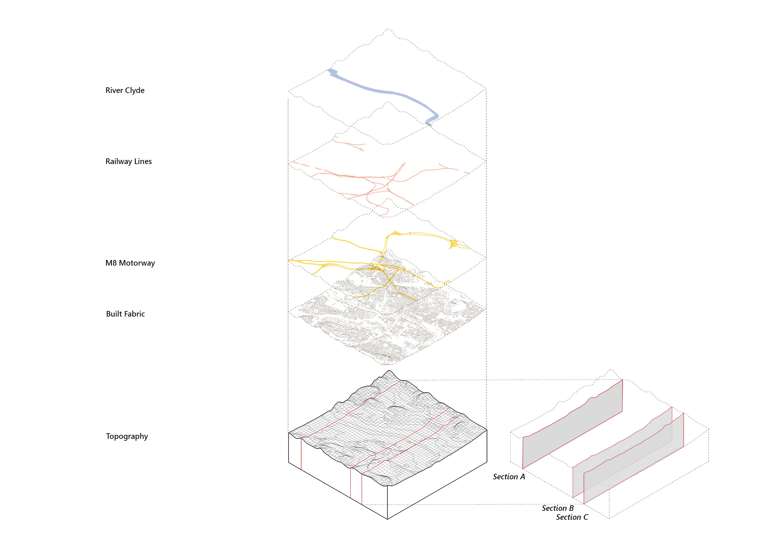
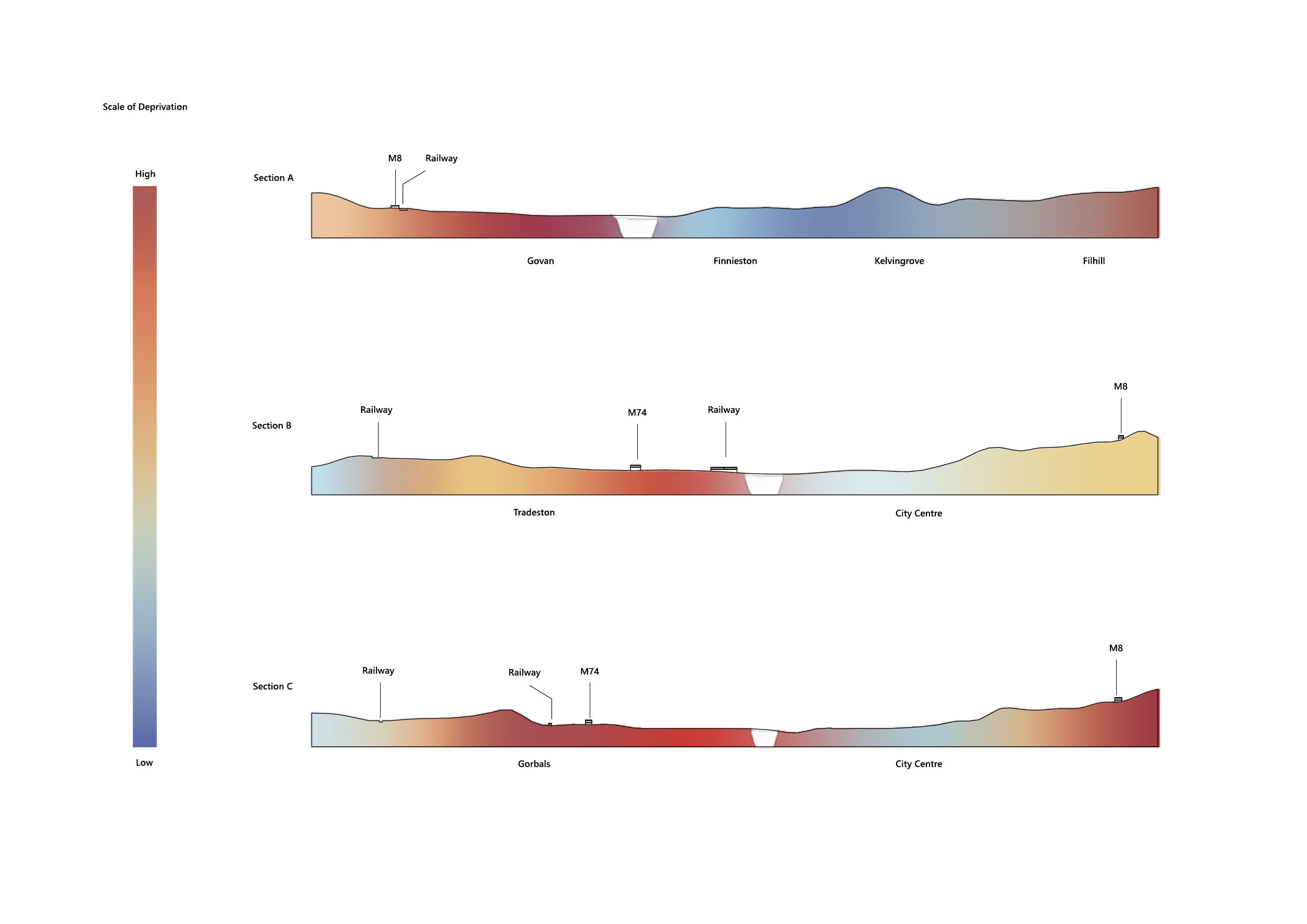
Glasgow hosts a variety of different social and economical conditions. Geographical, topographical and climactic conditions certainly play a role in facilitating this. Glasgow’s urban fabric stages many opportunities for connections and disconnections from access to transport and infrastructure on a domestic and industrial scale. The river Clyde has been a crucial factor in forming Glasgow’s character over the years. Through the use of diagrammatic illustration of how the river, motorways, railways and urban fabric are overlaid and interwoven, perhaps we can gain some further insight into how certain conditions are formed by the play of these factors. Three sections lines have been drawn that cut from North to South spanning roughly 2.5 km on either side of the River Clyde. The sections are drawn trough key areas in the city centre that tie together focal nodes for Glasgow’s infrastructure. There is a clear divide in social and economic depravation and welfare surrounding the North and South banks of the river Clyde. Green spaces in Glasgow such as Kelvingrove park and Queen’s Park represent a lower level of deprivation. By analysing certain areas in more detail, hopefully these drawings can spark a deeper understanding and generate questioning on how Glasgow functions as a city.
Key Themes: Boundaries, Density